Pierce County, Wisconsin
(as shown on our "plus" website)
Scroll down to see all listings in Pierce County
click on
View Video
to play video full screen, with sound or stop action.
Numbers in brackets show height, difficulty, and minutes to access waterfalls
 6-24-16 |
Boy Scout Falls:
View Video Latitude: 44.852493 Longitude: -92.631263 (9-6-70) Boy Scout Falls is in northwestern Pierce County. This beautiful 9 foot falls is in the city of River Falls and it is a little difficult to visit (hopefully someone will get the fallen tree out of the picture before you visit). After you have visited Glen Park Falls you need to carefully find your way upstream over the slippery rocks to Boy Scout Falls (270 yards upstream). That is the only public access to the falls... all adjoining land is private property! (However, if you know someone in the River Falls Boy Scouts Organization you might get them to allow your access to the stream behind their property on Vine Street and not have to wade up the stream). If you wade the stream, take a walking stick to help you over the slippery rocks. |
|
 12-9-20 |
GasLite Bar&Grill Falls:
View Video Latitude: 44.730792 Longitude: -92.583009 (2-2-30) This falls is on private land so you need to ask permission before going to the area!!! The property where this falls is located is owned by the GasLite Bar&Grill which is located at W8941 U.S. Highway 10 in Trimbelle. The falls is in the Trimbelle River and has an overall rambling drop of about 2 feet. The area where the falls is located looks like it's in a park... but the area and ball diamond in the area are all provided as a public service by the GasLite Bar&Grill, so give them a big thanks! And, by the way, they have a fabulous Friday night fish fry!!! To get to the falls go south on County Road "O" for 0.1 miles and turn right toward the ball diamond... keep to the left of the ball diamond and go west toward the bridge that you see over Trimbelle River. The bridge is closed and the falls are under the bridge. |
|
 6-24-16 |
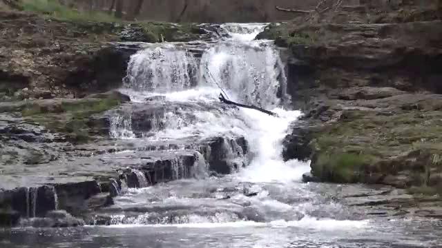
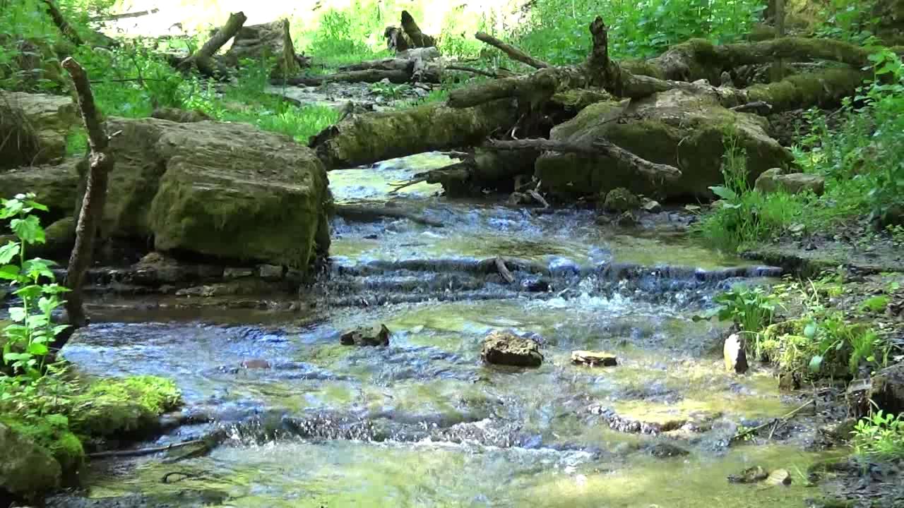
Glen Park Falls:
View Video Latitude: 44.853960 Longitude: -92.633530 (20-3-40) Glen Park Falls is in northwestern Pierce County. This is a very beautiful falls with 4 or 5 ledges and an overall estimated drop of 20 feet. Just upstream of the falls is a swinging bridge over the gorge that also provides a nice view of the falls. These falls are in Glen Park on the South Fork of the Kinnickinnic River and are upstream from Junction Falls (see location above). To see these falls you will need to walk upstream from Junction Falls by wading across a small stream, or jumping across some rocks (be careful... we found the rocks are quite slippery).
|
|
 5-15-20 |
Hidden Falls:
View Video Latitude: 44.830154 Longitude: -92.741775 (12-8-130) Hidden Falls is in Kinnickinnic State Park on the "Red Trail" which is south of the Kinnickinnic River. From downtown River Falls go south on Route 29 for 1.7 miles and turn right onto County Road "FF", then follow "FF" for 5.3 miles to left onto County Road "F", then 0.5 miles to right onto 770th St., then 0.45 miles to a parking lot on the right. This is a Wisconsin State Park parking lot so you must have a State Park sticker on your windshield or you will be ticketed! From the parking lot, the Red Trail is a loop trail of 2.9 miles (you don't need to do the entire 2.9 miles to see the falls... it's about 1.2 miles to the falls area... so out and back would be 2.4 miles). There is a sign on the trail when you reach the Hidden Falls area... and you normally can hear the falls from the trail... a side "trail" is marked "travel at your own risk"!!! It is a very dangerous trail and next to impossible to get down to the falls area!!! If you don't have a good walking stick, an 80 foot rope and good climbing shoes, don't attempt the trail!!! |
|
 5-15-20 |
Hidden Falls Upper:
View Video Latitude: 44.829823 Longitude: -92.741897 (2-4-110) Hidden Falls Upper is about 50 yards upstream from Hidden Falls... if you made it to Hidden Falls and are even "crazier", make your way upstream to a smaller falls that is kinda cute. After viewing Hidden Falls Upper, I managed the almost impossible task of climbing due west (sometimes on hands and knees... yes, my trousers were a mess) out of the 100 yard deep gorge area up thru brush, woods and prickles to the main Red Trail and made my way back to the car. This entire "adventure of absolute exhaustion" only took a little over 4 hours!
|
|
 4-10-16 |
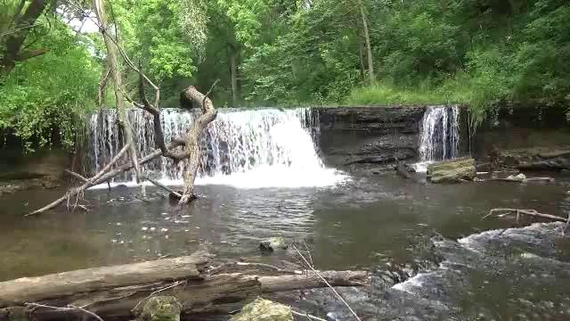
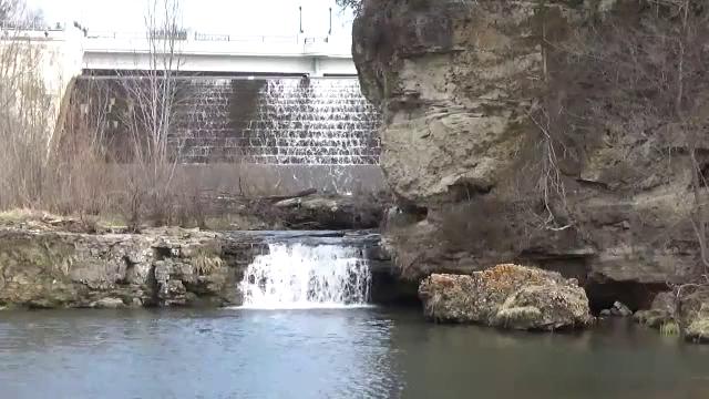
Junction Falls & Lake George Spillway:
View Video Junction Falls -- Latitude: 44.854953 Longitude: -92.634075 (6-2-40) Lake George Spillway -- Latitude: 44.855261 Longitude: -92.633440 Junction Falls is in northwestern Pierce County. This picture shows both the 6 foot Junction Falls (sometimes called River Falls) and the Lake George Spillway in the background. This area is easily accessed by walking down trails from Glen Park. Glen Park is in the southern part of city of River Falls just west of South Main Street on West Park Street. Junction Falls is so named because it is at the junction of the Kinnickinnic River and the South Fork of the Kinnickinnic River.
|
|
 12-9-20 |
Pine Creek Falls:
View Video Latitude: 44.544268 Longitude: -92.280626 (1-1-20) The Pine Creek area is an interesting area... the land is owned by the West Wisconsin Land Trust and is know as Pine Creek Park (sorry, it has no amenities... not even an outhouse). What you see in the 3 pictures and video is a beautiful trout stream... catch limit 3 trout 8" or bigger. The area is 1.8 miles southeast of Maiden Rock... from Maiden Rock travel 1.34 miles south on Route 35 and turn left onto County Road "A"... at 0.66 miles east on County Road "A" you will find a very small parking lot for Pine Creek Lower Falls (see further description below about Pine Creek Lower Falls). Continue on another 0.1 miles and County "A" takes a 90 degree right turn and crosses a bridge over Pine Creek... the photo at left was taken from the bridge. I did not wade the stream to measure it but it appears to be about an 18 inch drop. The Pine Creek Upper falls (see further description below about Pine Creek Upper Falls) is found by continuing on south, from the bridge on County "A", another 0.1 miles to a left onto 20th Avenue and then 0.16 miles to another parking lot. |
|
 12-9-20 |
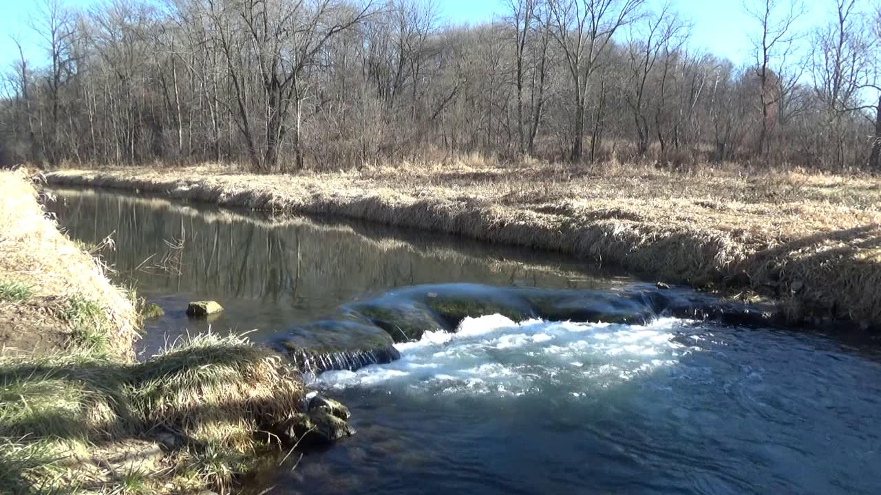
Pine Creek Lower Falls:
View Video Latitude: 44.543748 Longitude: -92.283165 (2-1-40) After parking in the very small parking lot you will find a well beaten path going south thru the prairie grass... from the parking lot you can hear the falls... 40 yards down the path you will see the falls that we estimate as a 2 foot drop... the largest drop of the 3 or 4 falls in the area. We didn't have room in the description above to tell you about the town of Maiden Rock and its legend... an Indian maiden supposedly threw herself off the bluff after being betrothed to a brave she despised... when you see the bluffs you will believe she died! Maiden Rock is actually 4.2 miles south of the town of Maiden Road along Route 35... If you want to visit the bluff trails continue on south from the bridge over Pine Creek... County Road "A" in 0.3 miles from the bridge turns into County Road "E" as you enter Pepin County... continue on County "E" for 2.8 miles to a right onto Long Lane... at 0.7 miles at the end of Long Lane there is a parking lot marked Maiden Rock Bluff State Natural Area and a trail leading to the bluff where the Indian maiden supposedly died. |
|
 12-9-20 |
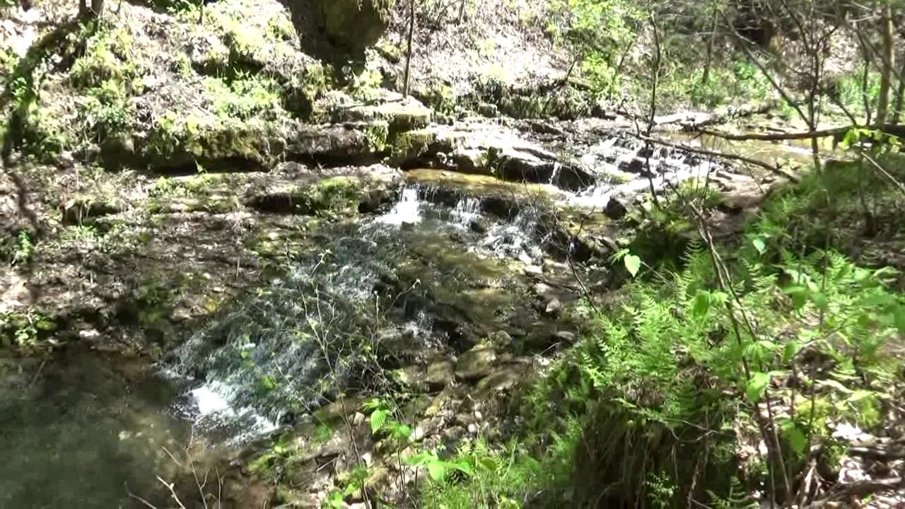
Pine Creek Upper Falls:
View Video Latitude: 44.544157 Longitude: -92.277514 (1-1-40) The Upper Falls is found by walking North from the parking lot described above in the Pine Creek Falls description about 150 yards along a well defined path. In the foreground of the picture you see at left is a 6 foot deep pool of the clearest water I have ever seen... you can see the bottom six feet down absolutely clear! Kept looking for some trout but did not see any. If you walk another 60 yards on downstream from this point you will find another 12 to 18 inch falls that I did not record, but it's worth a quick look. All in all, I enjoyed this entire area very, very much... the falls are not immense but the stream is beautiful!
|
|
 4-10-16 |
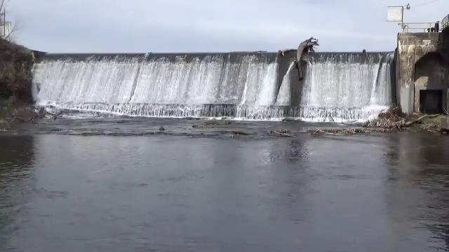
Powell Spillway:
View Video Latitude: 44.850980 Longitude: -92.639070 Just downstream from Junction Falls the Kinnickinnic River flows into and creates Lake Louise. Powell Spillway is the outlet from Lake Louise and can be reached by walking down a path from the southwest corner of Glen Park. From the parking lot at the tennis courts in Glen Park it is a path of 300 yards with 90 wood steps to get down to the river. This spillway is impressive with a drop of probably close to 30 feet. |
|
 12-9-20 |
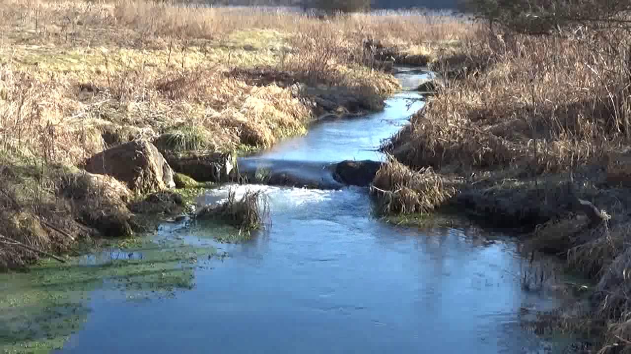
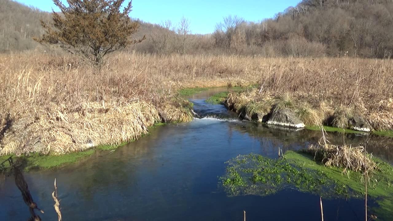
Trimbelle River Falls:
View Video Latitude: 44.725901 Longitude: -92.577719 (2-1-35) The Trimbelle Recreation Area program has created an unusual area along the Trimbelle River south of Trimbelle called the Streambank Easement Program which provides access to the area for people to hike and fish along the Trimbelle River. There is a parking area 0.5 miles south of Trimbelle on County Road "O". At the parking area you will find a paved pathway going northeast and a mowed grass pathway heading due east from the parking lot... take the mowed grass pathway and in 0.1 of a mile you will arrive at the falls shown on the left. There is a pedestrian bridge over the river just downriver (notice the shadows in the picture at left) so you can view the falls from both sides of the river. The falls are not huge (12 to 18" variety), but it is a great place to enjoy nature, hike and do a little fishing!
|
|
 12-9-20 |
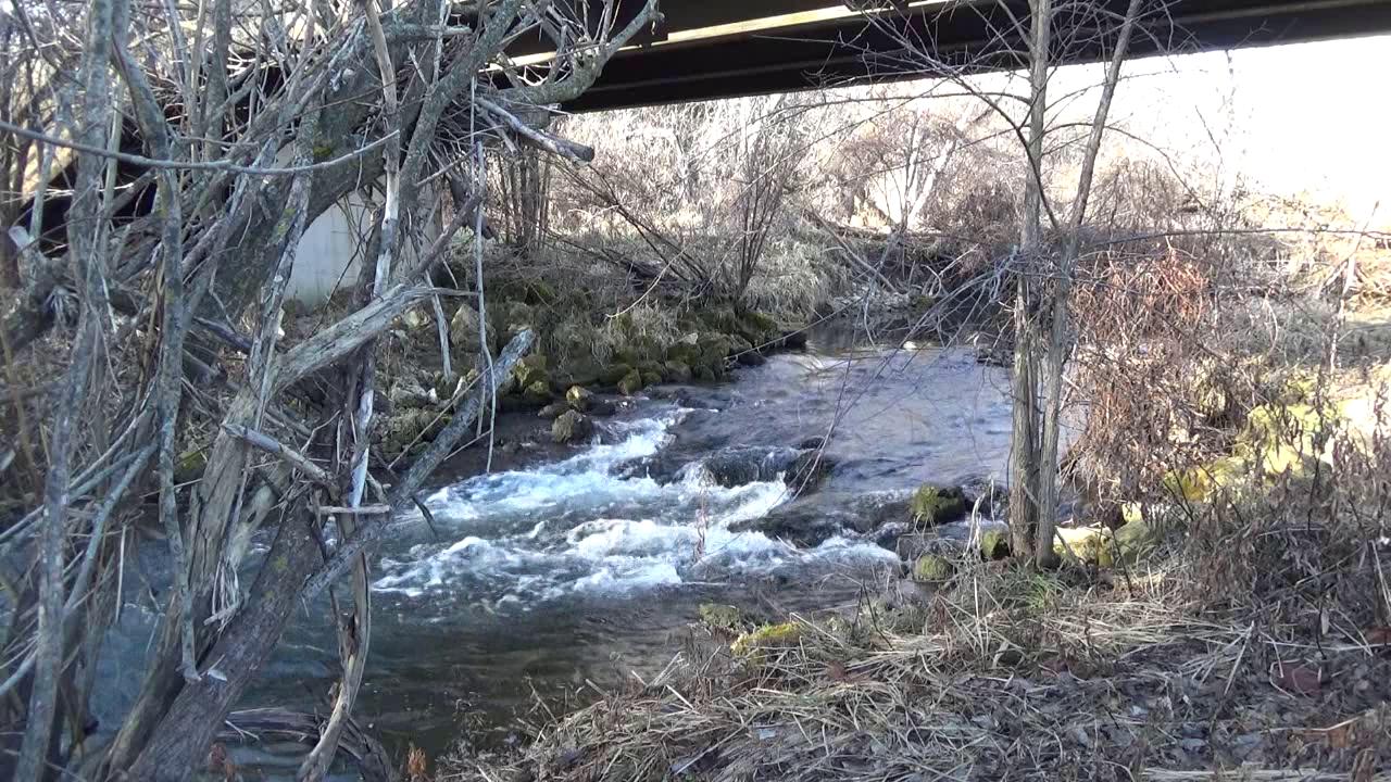
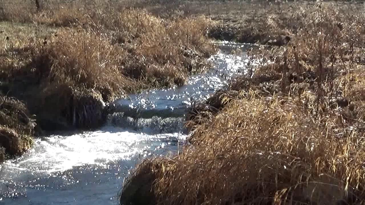
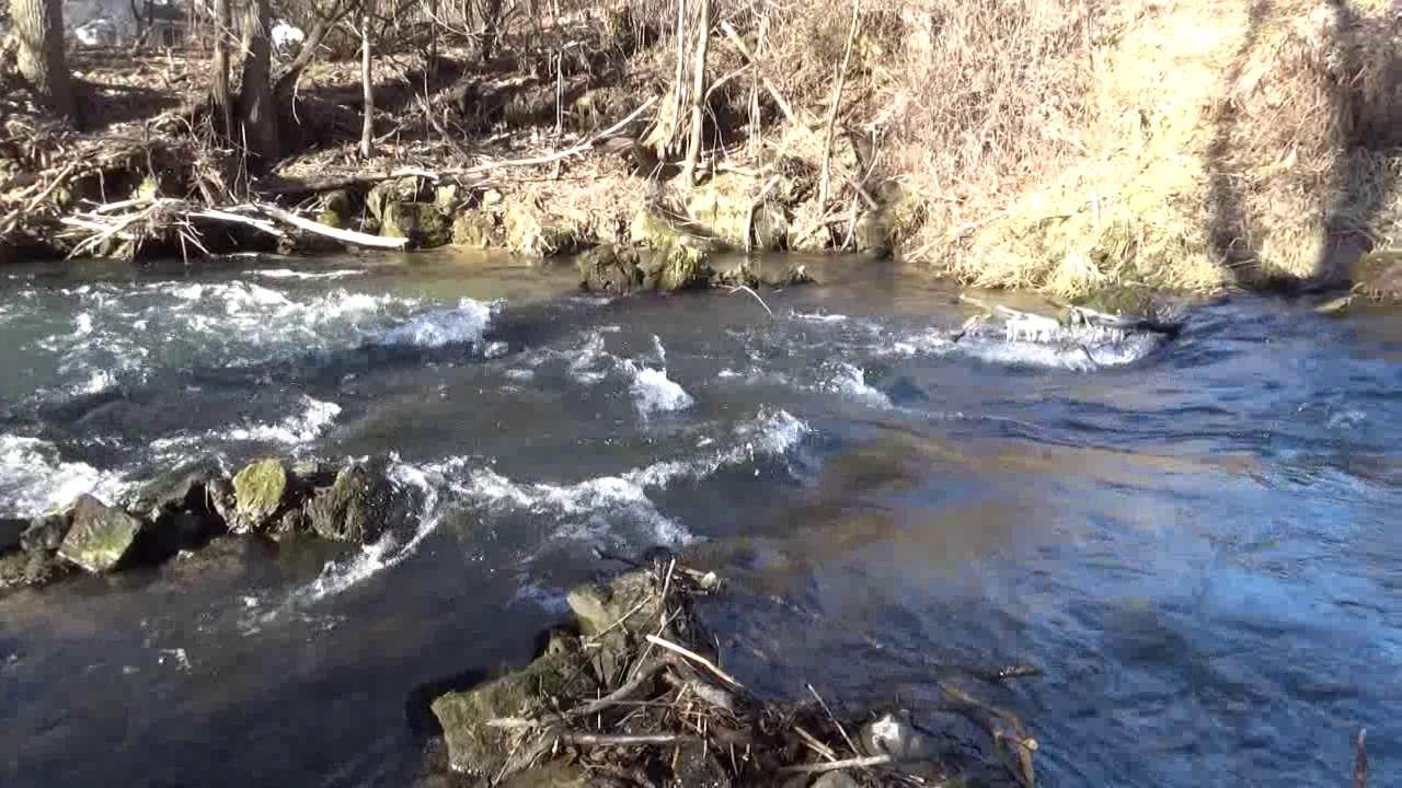
Trimbelle River Rapids:
View Video Latitude: 44.736193 Longitude: -92.577458 Go north from Trimbelle on County Road "O" for 0.46 miles and you will find 560th Avenue going off to the east and immediately a bridge going over the Trimbelle River. North and south and under the bridge you will find the rapids shown at left. Difficult to photograph because access is only available from the east side of the river (provided by a fishing easement). The west side would provide excellent views of the rapids but the west side is a private park named Leonard Park... well posted with "Keep Out Private" signs.
|
|